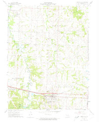
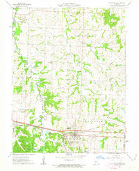
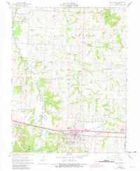
1962 Map of Knob Noster
USGS Topo · Published 1974About this map
Knob Noster serves as the primary hub of this Johnson County landscape, situated along the east-west rail and road corridor. The topography is defined by the northern flow of the Blackwater River, which is fed by an intricate network of tributaries including Clear Fork, Walnut Creek, and Little Walnut Creek. These waterways carve through the terrain, creating a series of ridges and valleys that influenced the placement of early rural settlements like Valley City.
Find a feature on this map
8 named features on this map. Tap any name to fly to it.
Don’t see what you’re looking for? This feature index may not catch every label — zoom into the map to look around manually.
Map Details
Editions of this 1962 Knob Noster Map
3 editions found
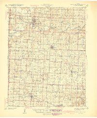
Other maps of this area

1885 · Warrensburg
USGS Topo · 1:125,000

1887 · Sedalia
USGS Topo · 1:125,000

1887 · Warrensburg
USGS Topo · 1:125,000

1894 · Sedalia
USGS Topo · 1:125,000

1894 · Warrensburg
USGS Topo · 1:125,000

1917 · Knobnoster
USGS Topo · 1:62,500

1939 · Sweet Springs
USGS Topo · 1:62,500

1940 · Sweet Springs
USGS Topo · 1:62,500
1941 · Sweet Springs
USGS Topo · 1:62,500

1945 · Sweet Springs
USGS Topo · 1:62,500