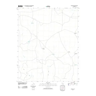
2010 Map of Knoblaw
USGS Topo · Published 2010About this map
Knoblaw serves as the focal point for this Oldham County ranching landscape, characterized by a sophisticated network of water management features essential for high-plains survival. The terrain is carved by drainage systems such as Sidle Canyon and Chisum Canyon, which guide seasonal runoff toward Horse Creek and Minneosa Creek. Water security in this arid region is documented through a series of named improvements, including the Thousand Dollar Dam and various tanks like Red Tank and West Bull Spring Tank. Local family names and cattle company history are reflected in landmarks such as Chisum Spring, while the continued reliance on wind power is evidenced by the South Santa Fe Windmill and West Chavez Windmill. This map provides a clear picture of how isolated settlements and ranching operations organized around vital water sources and the local topography in the early 21st century.
Find a feature on this map
13 named features on this map. Tap any name to fly to it.
Don’t see what you’re looking for? This feature index may not catch every label — zoom into the map to look around manually.
Map Details
Editions of this 2010 Knoblaw Map
This is the sole edition of this map. No revisions or reprints were ever made.
Other maps of this area

1954 · Tucumcari
USGS Topo · 1:250,000

1958 · Tucumcari
USGS Topo · 1:250,000

1966 · Vat Camp
USGS Topo · 1:24,000

1966 · Trujillo Camp
USGS Topo · 1:24,000

1968 · Sanchez Springs
USGS Topo · 1:24,000

1971 · Romero SE
USGS Topo · 1:24,000

1971 · Doyle Hill
USGS Topo · 1:24,000

1971 · Nara Visa
USGS Topo · 1:24,000

1971 · Knoblaw
USGS Topo · 1:24,000

1971 · Spring Creek Ranch
USGS Topo · 1:24,000