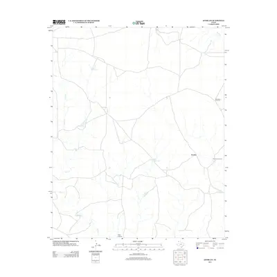
2012 Map of Knoblaw
USGS Topo · Published 2012About this map
Knoblaw serves as the central point of reference in this ranching landscape of Oldham County, where water management defines the human footprint on the High Plains. The area is characterized by an extensive network of ephemeral drainages, most notably Horse Cr and Minneosa Cr, which flow toward the rugged breaks of the Canadian River valley. To sustain livestock in this semi-arid environment, ranchers established numerous water features such as W Bull Spring Tank, Red Tank, and the Little Forker Tank. Further evidence of deep-rooted ranching history is found at Chisum Spring and near the southern edge of the survey at Sidle Canyon. This modern digital survey provides a precise record of how historical land use, including several named windmills like the Lake Windmill, continues to shape the geography of the Texas Panhandle.
Find a feature on this map
11 named features on this map. Tap any name to fly to it.
Don’t see what you’re looking for? This feature index may not catch every label — zoom into the map to look around manually.
Map Details
Editions of this 2012 Knoblaw Map
This is the sole edition of this map. No revisions or reprints were ever made.
Other maps of this area

1954 · Tucumcari
USGS Topo · 1:250,000

1958 · Tucumcari
USGS Topo · 1:250,000

1966 · Vat Camp
USGS Topo · 1:24,000

1966 · Trujillo Camp
USGS Topo · 1:24,000

1968 · Sanchez Springs
USGS Topo · 1:24,000

1971 · Romero SE
USGS Topo · 1:24,000

1971 · Doyle Hill
USGS Topo · 1:24,000

1971 · Nara Visa
USGS Topo · 1:24,000

1971 · Knoblaw
USGS Topo · 1:24,000

1971 · Spring Creek Ranch
USGS Topo · 1:24,000