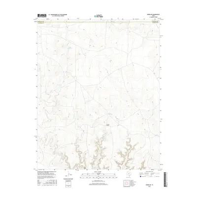
2016 Map of Knoblaw
USGS Topo · Published 2016About this map
The High Plains of the Texas Panhandle define this landscape along the border of Hartley Co and Oldham Co. This area is characterized by an intricate network of drainage systems and cattle tanks, reflecting a land dedicated to ranching and water management. Chisum Canyon and Sidle Canyon carve deep paths through the terrain in the southern portion of the sheet, providing significant geographic relief. Water sources are the primary landmarks in this sparsely populated region, ranging from the naturally occurring Chisum Spring to man-made features like W Bull Spring Tank and Red Tank. The presence of several named drainages, including Horse Cr and Minneosa Cr, underscores the importance of seasonal hydrology in this part of Oldham County.
Find a feature on this map
10 named features on this map. Tap any name to fly to it.
Don’t see what you’re looking for? This feature index may not catch every label — zoom into the map to look around manually.
Map Details
Editions of this 2016 Knoblaw Map
This is the sole edition of this map. No revisions or reprints were ever made.
Other maps of this area

1954 · Tucumcari
USGS Topo · 1:250,000

1958 · Tucumcari
USGS Topo · 1:250,000

1966 · Vat Camp
USGS Topo · 1:24,000

1966 · Trujillo Camp
USGS Topo · 1:24,000

1968 · Sanchez Springs
USGS Topo · 1:24,000

1971 · Romero SE
USGS Topo · 1:24,000

1971 · Doyle Hill
USGS Topo · 1:24,000

1971 · Nara Visa
USGS Topo · 1:24,000

1971 · Knoblaw
USGS Topo · 1:24,000

1971 · Spring Creek Ranch
USGS Topo · 1:24,000