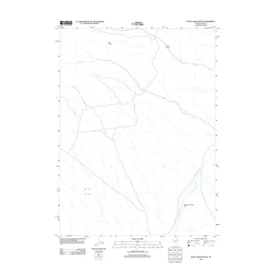
2012 Map of Knoll Mountain SE
USGS Topo · Published 2012About this map
Thousand Springs Creek meanders through a landscape defined by the high desert basins of northeast Nevada, offering a detailed view of the water sources and drainage patterns essential to this region. The map tracks the seasonal waters of Burnt Creek as they flow from the rugged slopes of the H D Range, carving through the earth toward the broad Thousand Springs Valley. This 2012 survey illustrates the network of unpaved local roads and trails that intersect the terrain, including the primary corridor of Co HWY 765. The topography reveals the natural barriers and canyons, such as Corral Canyon, that have influenced ranching and land use in this part of Elko County. It is a precise record of the physical geography and minor infrastructure of a remote portion of the Great Basin.
Find a feature on this map
6 named features on this map. Tap any name to fly to it.
Don’t see what you’re looking for? This feature index may not catch every label — zoom into the map to look around manually.
Map Details
Editions of this 2012 Knoll Mountain SE Map
This is the sole edition of this map. No revisions or reprints were ever made.
Other maps of this area

1955 · Wells
USGS Topo · 1:250,000

1958 · Wells
USGS Topo · 1:250,000

1961 · Wells
USGS Topo · 1:250,000

1961 · Delano Mountains
USGS Topo · 1:62,500

1967 · Ninemile Mtn
USGS Topo · 1:24,000

1968 · Knoll Mountain
USGS Topo · 1:24,000

1968 · Knoll Mountain SE
USGS Topo · 1:24,000

1968 · Wine Cup Ranch
USGS Topo · 1:24,000

1968 · Blanchard Mtn
USGS Topo · 1:24,000

1968 · Texas Spring
USGS Topo · 1:24,000