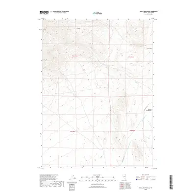
2018 Map of Knoll Mountain SE
USGS Topo · Published 2018About this map
H D Range and the high summit of Knoll Mtn define this northeastern Nevada landscape, where high-desert drainage patterns dictate the region's geography. The watershed is anchored by Burnt Cr in the north and the southward flow of Thousand Springs Cr, which meanders through the expansive Thousand Springs Valley. This 2018 survey illustrates a remote area of Elko County largely shaped by its topography, featuring the deep incision of Corral Canyon and the strategic path of the Wilkins-Montello Rd as it skirts the mountain ranges. The map provides a precise look at the township and range system, including t43n r65e, t43n r66e, t42n r65e, and t42n r66e, showing how survey boundaries align with the natural contours of the Great Basin.
Find a feature on this map
11 named features on this map. Tap any name to fly to it.
Don’t see what you’re looking for? This feature index may not catch every label — zoom into the map to look around manually.
Map Details
Editions of this 2018 Knoll Mountain SE Map
This is the sole edition of this map. No revisions or reprints were ever made.
Other maps of this area

1955 · Wells
USGS Topo · 1:250,000

1958 · Wells
USGS Topo · 1:250,000

1961 · Wells
USGS Topo · 1:250,000

1961 · Delano Mountains
USGS Topo · 1:62,500

1967 · Ninemile Mtn
USGS Topo · 1:24,000

1968 · Knoll Mountain
USGS Topo · 1:24,000

1968 · Knoll Mountain SE
USGS Topo · 1:24,000

1968 · Wine Cup Ranch
USGS Topo · 1:24,000

1968 · Blanchard Mtn
USGS Topo · 1:24,000

1968 · Texas Spring
USGS Topo · 1:24,000