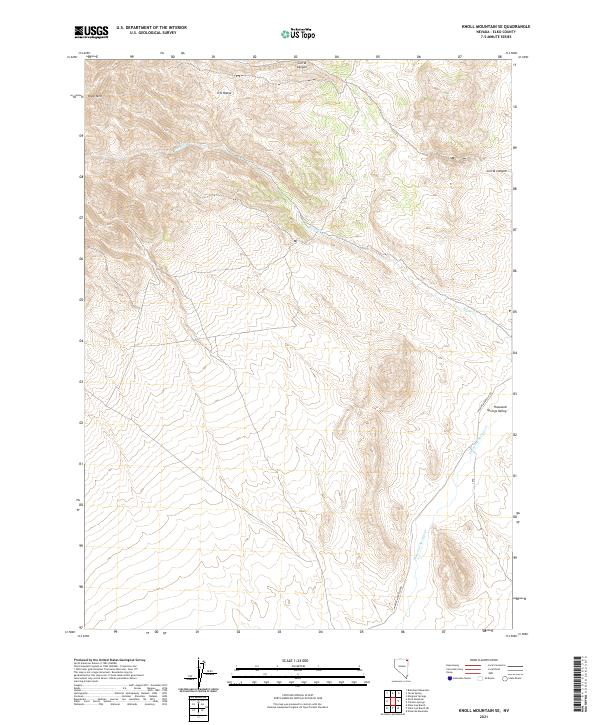
2021 Map of Knoll Mountain SE
USGS Topo · Published 2021About this map
Knoll Mtn and the southern reaches of the H D Range dominate this high-desert landscape in northeastern Nevada. The terrain is defined by a series of steep drainages including Corral Canyon and the seasonal waters of Burnt Cr, which flow toward the more prominent Thousand Springs Cr in the southeast. This area is characterized by its isolation and the clear grid of the Public Land Survey System, which divides the township lines of t43n r65e and t42n r66e. Transportation through this corner of the state is limited to the Wilkins-Montello Rd, which skirts the edge of the Thousand Springs Valley. The map detail highlights the dramatic elevation changes and the specific hydrology that dictated movement and grazing patterns in this part of Elko County.
Find a feature on this map
11 named features on this map. Tap any name to fly to it.
Don’t see what you’re looking for? This feature index may not catch every label — zoom into the map to look around manually.
Map Details
Editions of this 2021 Knoll Mountain SE Map
This is the sole edition of this map. No revisions or reprints were ever made.
Other maps of this area

1955 · Wells
USGS Topo · 1:250,000

1958 · Wells
USGS Topo · 1:250,000

1961 · Wells
USGS Topo · 1:250,000

1961 · Delano Mountains
USGS Topo · 1:62,500

1967 · Ninemile Mtn
USGS Topo · 1:24,000

1968 · Knoll Mountain
USGS Topo · 1:24,000

1968 · Knoll Mountain SE
USGS Topo · 1:24,000

1968 · Wine Cup Ranch
USGS Topo · 1:24,000

1968 · Blanchard Mtn
USGS Topo · 1:24,000

1968 · Texas Spring
USGS Topo · 1:24,000