
2010 Map of Knott SW
USGS Topo · Published 2010About this map
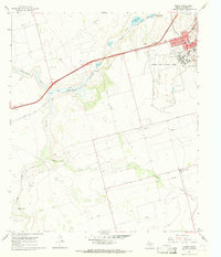
Knott Cemetery stands as a focal point for family history in this corner of Howard County, marking a quiet landscape defined by ephemeral water features and a grid of rural section roads. The geography is dominated by the broad, seasonal drainage systems of Sulphur Springs Draw and Buzzard Draw, which channel runoff across the plains toward larger catchments like Natural Dam Lake and Red Lake. This network of draws and intermittent lakes suggests a reliance on natural topography for water management in an arid environment. The road system, including routes like Wilkinson Rd and numerous numbered county roads, illustrates a highly organized agricultural or ranching partition of the land, providing a clear window into early 21st-century rural Texas land use before significant modern encroachment.
Find a feature on this map
25 named features on this map. Tap any name to fly to it.
Don’t see what you’re looking for? This feature index may not catch every label — zoom into the map to look around manually.
Map Details
Editions of this 2010 Knott SW Map
This is the sole edition of this map. No revisions or reprints were ever made.
Other maps of this area

1941 · Morita
USGS Topo · 1:62,500

1949 · Morita
USGS Topo · 1:62,500

1954 · Big Spring
USGS Topo · 1:250,000

1958 · Big Spring
USGS Topo · 1:250,000

1966 · Knott
USGS Topo · 1:24,000

1966 · Merrick
USGS Topo · 1:24,000

1966 · Natural Dam Lake
USGS Topo · 1:24,000

1966 · Knott SE
USGS Topo · 1:24,000
1966 · Elbow
USGS Topo · 1:24,000

1966 · Stanton
USGS Topo · 1:24,000