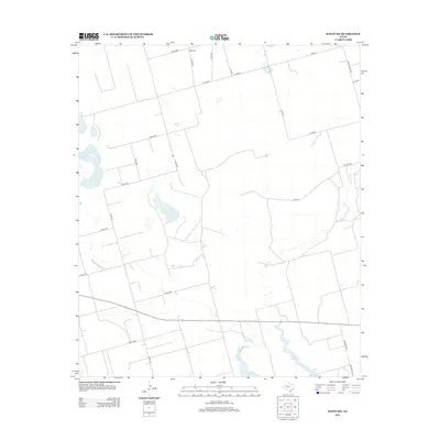
2012 Map of Knott SW
USGS Topo · Published 2012About this map
Natural Dam Lake and the smaller Red Lake define the hydrology of this semi-arid landscape in Howard County, where the terrain is marked by seasonal basins and an organized grid of ranch roads. The presence of Knott Cem at the northern boundary serves as a localized landmark for genealogists and family researchers tracking the area's rural residents. The map's transport network is dominated by county corridors such as Co RD-3000 and Co RD-2900, illustrating a low-density settlement pattern built around large land tracts. Notable road transitions, such as the shift from Wilkenson Rd to Wilkerson Rd, reflect the nuances of local property and naming conventions near Ranch Road 2230 during the early 21st century.
Find a feature on this map
26 named features on this map. Tap any name to fly to it.
Don’t see what you’re looking for? This feature index may not catch every label — zoom into the map to look around manually.
Map Details
Editions of this 2012 Knott SW Map
This is the sole edition of this map. No revisions or reprints were ever made.
Other maps of this area

1941 · Morita
USGS Topo · 1:62,500

1949 · Morita
USGS Topo · 1:62,500

1954 · Big Spring
USGS Topo · 1:250,000

1958 · Big Spring
USGS Topo · 1:250,000

1966 · Knott
USGS Topo · 1:24,000

1966 · Merrick
USGS Topo · 1:24,000

1966 · Natural Dam Lake
USGS Topo · 1:24,000

1966 · Knott SE
USGS Topo · 1:24,000
1966 · Elbow
USGS Topo · 1:24,000

1966 · Stanton
USGS Topo · 1:24,000