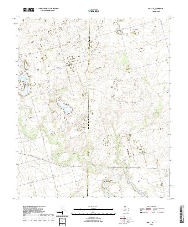
2022 Map of Knott SW
USGS Topo · Published 2022About this map
The Martin Co / Howard Co line bisects this West Texas landscape, where the open terrain is defined by seasonal watercourses and dispersed ranch roads. The presence of Knott Cem in the northern portion of the sheet provides a focal point for genealogical research in this rural pocket of the state. These high plains are carved by the distinct paths of Sulphur Springs Draw and Buzzard Draw, which dictate the local topography and the placement of historic crossings.
Find a feature on this map
26 named features on this map. Tap any name to fly to it.
Don’t see what you’re looking for? This feature index may not catch every label — zoom into the map to look around manually.
Map Details
Editions of this 2022 Knott SW Map
This is the sole edition of this map. No revisions or reprints were ever made.
Other maps of this area

1941 · Morita
USGS Topo · 1:62,500

1949 · Morita
USGS Topo · 1:62,500

1954 · Big Spring
USGS Topo · 1:250,000

1958 · Big Spring
USGS Topo · 1:250,000

1966 · Knott
USGS Topo · 1:24,000

1966 · Merrick
USGS Topo · 1:24,000

1966 · Natural Dam Lake
USGS Topo · 1:24,000

1966 · Knott SE
USGS Topo · 1:24,000
1966 · Elbow
USGS Topo · 1:24,000

1966 · Stanton
USGS Topo · 1:24,000