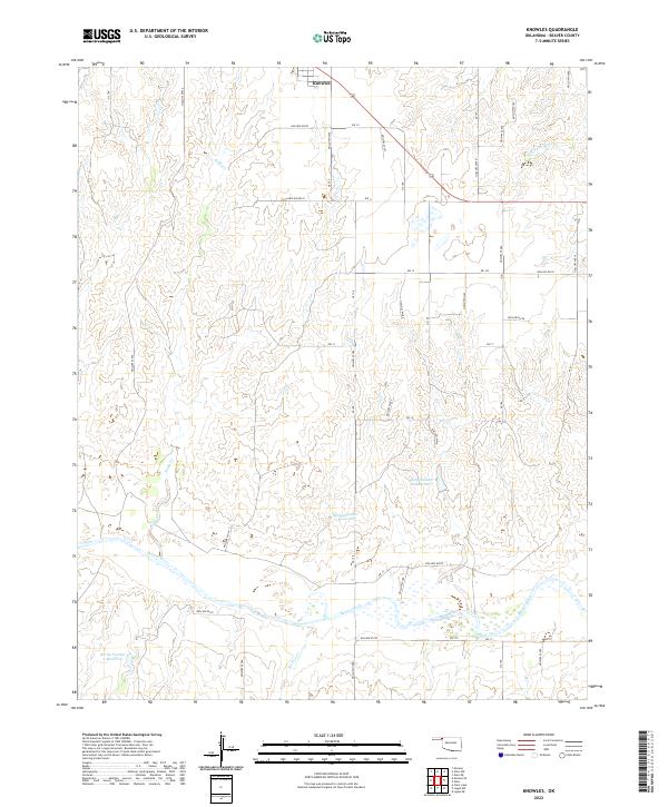
2022 Map of Knowles
USGS Topo · Published 2022About this map
Knowles serves as the primary settlement hub in this part of the Oklahoma panhandle, situated near the intersection of several section-line roads. The landscape is defined by the winding course of the Beaver River, which flows through the southern portion of the quadrangle, flanked by numerous small water management features. These include specialized basins such as Barby Number 18 Reservoir, Barby Number 3 Reservoir, and Barby Number 5 Reservoir, indicating the area's focus on water storage for agricultural use. Small drainage systems like Kidds Cr, Mexico Cr, and W Fork Horse Cr cut across the high plains terrain. The map's grid is dominated by a systematic network of hollows and section roads, reflecting the organized ranching and farming operations characteristic of Beaver County's modern rural geography.
Find a feature on this map
45 named features on this map. Tap any name to fly to it.
Don’t see what you’re looking for? This feature index may not catch every label — zoom into the map to look around manually.
Map Details
Editions of this 2022 Knowles Map
This is the sole edition of this map. No revisions or reprints were ever made.
Other maps of this area

1954 · Perryton
USGS Topo · 1:250,000

1958 · Perryton
USGS Topo · 1:250,000

1970 · Knowles
USGS Topo · 1:24,000

1970 · Gate
USGS Topo · 1:24,000
1970 · Gate NE
USGS Topo · 1:24,000

1970 · Gate NW
USGS Topo · 1:24,000

1970 · Mocane SE
USGS Topo · 1:24,000
1970 · Mocane
USGS Topo · 1:24,000

1971 · Clear Lake
USGS Topo · 1:24,000

1971 · Logan NW
USGS Topo · 1:24,000