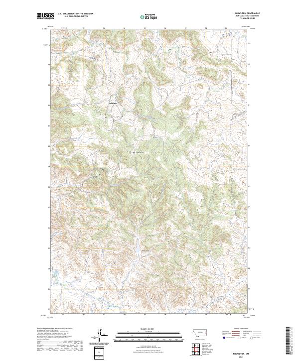
2024 Map of Knowlton
USGS Topo · Published 2024About this map
Knowlton and the surrounding rangelands of Custer County are defined by a complex network of seasonal drainages and isolated landmarks. Central to this landscape is White Knob, a prominent topographic feature rising above the headwaters of White Knob Creek and Tub S Creek. The map documents a sparsely populated area where life and movement are dictated by the terrain, with small roads like N Nolton Rd and Rd 417 connecting remote ranching sites. Local history is anchored by the Knowlton Cem, which sits near the center of the township, serving as a quiet marker of the community's generational ties to this stretch of eastern Montana. The hydrology of the region is notably intricate, featuring various forks and prongs such as Long Prong Locate Creek and North Fork Horse Creek that carve through the high plains.
Find a feature on this map
26 named features on this map. Tap any name to fly to it.
Don’t see what you’re looking for? This feature index may not catch every label — zoom into the map to look around manually.
Map Details
Editions of this 2024 Knowlton Map
This is the sole edition of this map. No revisions or reprints were ever made.
Other maps of this area

1953 · Miles City
USGS Topo · 1:250,000

1957 · Miles City
USGS Topo · 1:250,000

1958 · Miles City
USGS Topo · 1:250,000

1969 · Knowlton
USGS Topo · 1:24,000

1969 · Hogan Creek
USGS Topo · 1:24,000

1969 · Tepee Butte NE
USGS Topo · 1:24,000

1969 · Montague Butte
USGS Topo · 1:24,000
1969 · Pennock Creek
USGS Topo · 1:24,000
1969 · Red Knob
USGS Topo · 1:24,000
1980 · Miles City
USGS Topo · 1:100,000