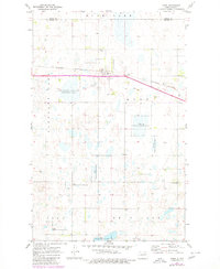
1971 Map of Knox
USGS Topo · Published 1980About this map
Knox serves as the central hub of this North Dakota landscape, situated along the Burlington Northern railroad line. The settlement's infrastructure includes a local Townhall and is supported by nearby spiritual and commemorative sites like St Marys Cem and Knox Cem. To the southeast, the Pleasant Valley Ch stands as a landmark of the rural community's social fabric.
Find a feature on this map
20 named features on this map. Tap any name to fly to it.
Don’t see what you’re looking for? This feature index may not catch every label — zoom into the map to look around manually.
Map Details
Editions of this 1971 Knox Map
2 editions found
Other maps of this area

1953 · Devils Lake
USGS Topo · 1:250,000

1956 · Devils Lake
USGS Topo · 1:250,000

1958 · Fillmore
USGS Topo · 1:24,000

1958 · Baker
USGS Topo · 1:24,000

1958 · Harlow
USGS Topo · 1:24,000

1971 · Wolford
USGS Topo · 1:24,000

1971 · Knox
USGS Topo · 1:24,000

1971 · Rugby NE
USGS Topo · 1:24,000

1971 · Hurricane Lake West
USGS Topo · 1:24,000

1971 · York
USGS Topo · 1:24,000