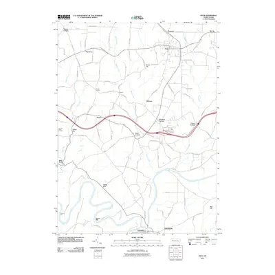
2010 Map of Knox
USGS Topo · Published 2010About this map
Canoe Furnace and the namesake hub of Knox anchor this portion of Clarion County, where a dense network of country roads connects historic crossroads settlements. The landscape is defined by the winding course of the Clarion River in the south and the sharp transition to industrial and agricultural clusters like Turkey City and Beaver City further north. Notable historical markers of local industry and settlement are evident in names like Martins Mill and Stovers Mill along the riverbanks, as well as several corner settlements such as Snively Corners and Wentlings Corners. A unique terrain feature known as the Turnip Hole is found within a sharp bend of the Clarion River, reflecting the distinct local nomenclature of the region's topography.
Find a feature on this map
88 named features on this map. Tap any name to fly to it.
Don’t see what you’re looking for? This feature index may not catch every label — zoom into the map to look around manually.
Map Details
Editions of this 2010 Knox Map
This is the sole edition of this map. No revisions or reprints were ever made.
Other maps of this area

1906 · Clarion
USGS Topo · 1:62,500

1907 · Clarion
USGS Topo · 1:62,500

1907 · Foxburg
USGS Topo · 1:62,500

1908 · Foxburg
USGS Topo · 1:62,500

1922 · Oil City
USGS Topo · 1:48,000

1922 · Tionesta
USGS Topo · 1:62,500

1924 · Oil City
USGS Topo · 1:62,500

1924 · Tionesta
USGS Topo · 1:62,500

1943 · Oil City
USGS Topo · 1:62,500

1946 · Tionesta
USGS Topo · 1:62,500