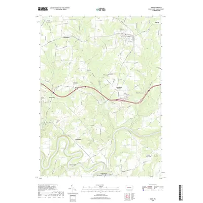
2019 Map of Knox
USGS Topo · Published 2019About this map
The Clarion River snakes through the southern reaches of this landscape, carving deep bends like the one at Turnip Hole and passing historical industrial sites such as Stovers Mill. Centered on the borough of Knox, the area is a patchwork of ridge-top settlements and crossroads including Wentlings Corners, Monroe, and Turkey City. The map reveals a high density of religious and commemorative sites for a rural district, ranging from the Saint Mark's United Church of Christ Cem to the Mount Zion Lutheran Church Cem in the southeast. This geography reflects a history of decentralized community life, where small clusters of homes and churches like Jefferson and Elk City anchored the surrounding townships. Legacy industrial markers, such as Canoe Furnace near the Canoe Cr drainage, point to the region's productive past along the river's rugged tributaries.
Find a feature on this map
100 named features on this map. Tap any name to fly to it.
Don’t see what you’re looking for? This feature index may not catch every label — zoom into the map to look around manually.
Map Details
Editions of this 2019 Knox Map
This is the sole edition of this map. No revisions or reprints were ever made.
Other maps of this area

1906 · Clarion
USGS Topo · 1:62,500

1907 · Clarion
USGS Topo · 1:62,500

1907 · Foxburg
USGS Topo · 1:62,500

1908 · Foxburg
USGS Topo · 1:62,500

1922 · Oil City
USGS Topo · 1:48,000

1922 · Tionesta
USGS Topo · 1:62,500

1924 · Oil City
USGS Topo · 1:62,500

1924 · Tionesta
USGS Topo · 1:62,500

1943 · Oil City
USGS Topo · 1:62,500

1946 · Tionesta
USGS Topo · 1:62,500