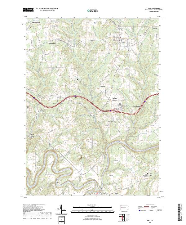
2023 Map of Knox
USGS Topo · Published 2023About this map
The Clarion River winds through the southern landscape of this Clarion County region, carving a deep valley that separates the northern uplands from the community of Callensburg. Near the river's sharpest bends, the map identifies local industrial and agricultural landmarks like Stovers Mill and Turnip Hole, alongside the early iron heritage represented by Canoe Furnace. The road network connects numerous small crossroad settlements including Turkey City, Wentlings Corners, and Alum Rock, illustrating a decentralized pattern of development common in rural Pennsylvania.
Find a feature on this map
145 named features on this map. Tap any name to fly to it.
Don’t see what you’re looking for? This feature index may not catch every label — zoom into the map to look around manually.
Map Details
Editions of this 2023 Knox Map
This is the sole edition of this map. No revisions or reprints were ever made.
Other maps of this area

1906 · Clarion
USGS Topo · 1:62,500

1907 · Clarion
USGS Topo · 1:62,500

1907 · Foxburg
USGS Topo · 1:62,500

1908 · Foxburg
USGS Topo · 1:62,500

1922 · Oil City
USGS Topo · 1:48,000

1922 · Tionesta
USGS Topo · 1:62,500

1924 · Oil City
USGS Topo · 1:62,500

1924 · Tionesta
USGS Topo · 1:62,500

1943 · Oil City
USGS Topo · 1:62,500

1946 · Tionesta
USGS Topo · 1:62,500