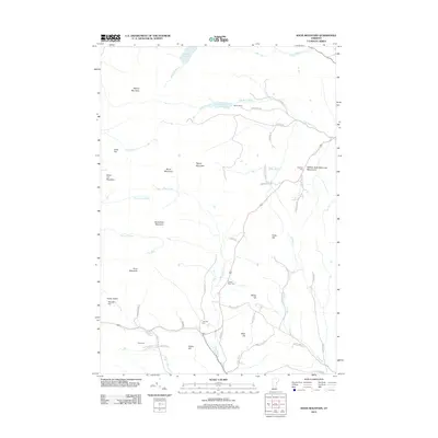
2012 Map of Knox Mountain
USGS Topo · Published 2012About this map
Spruce Mountain and the high ridges of the Washington County highlands dominate this 2012 survey, where the headwaters of the S Br Wells River and Waits River carve through a landscape of granite peaks and isolated notches. The mapping of Seyon Ranch near Noyes Pond reflects the area's legacy of upland agriculture and recreation. Local genealogy is well-documented through several historic burial grounds, including Westville Cem and Clement Cem, which are scattered along winding routes like Clement RD and Gore RD. A significant cultural landmark, the William Scott Memorial Monument, stands near the eastern border, honoring the 'Sleeping Sentinel' of the Civil War. The network of brooks, such as Nasmith Brook and Health Brook, illustrates the complex drainage patterns of this Vermont terrain before it descends toward the river valleys.
Find a feature on this map
56 named features on this map. Tap any name to fly to it.
Don’t see what you’re looking for? This feature index may not catch every label — zoom into the map to look around manually.
Map Details
Editions of this 2012 Knox Mountain Map
This is the sole edition of this map. No revisions or reprints were ever made.
Other maps of this area

1931 · Woodsville
USGS Topo · 1:48,000

1935 · Woodsville
USGS Topo · 1:62,500

1938 · St. Johnsbury
USGS Topo · 1:48,000

1939 · Plainfield
USGS Topo · 1:48,000

1940 · Plainfield
USGS Topo · 1:62,500

1941 · Woodsville
USGS Topo · 1:62,500

1943 · Plainfield
USGS Topo · 1:62,500

1943 · St. Johnsbury
USGS Topo · 1:62,500

1947 · Corinth
USGS Topo · 1:62,500

1948 · East Barre
USGS Topo · 1:62,500