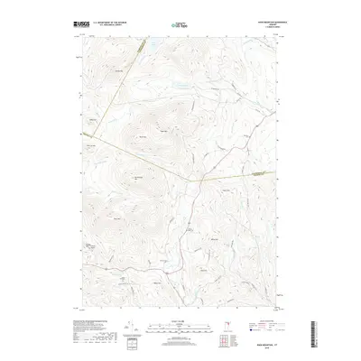
2018 Map of Knox Mountain
USGS Topo · Published 2018About this map
Highland ridges and deep valleys define this section of Vermont where the borders of Washington, Caledonia, and Orange counties meet. The peaks of Signal Mtn and Knox Mtn dominate the central terrain, while Noyes Pond and Pigeon Pond sit in the higher elevations to the north. These summits feed an intricate network of waterways, including the headwaters of the Waits River and the S Br Wells River, which carve narrow passages through the hills. Local history is etched into the landscape through family-named landmarks like Allen Hill and Willey Hill, alongside several small burial grounds including the Groton Road Cem and Westville Cem. The road network follows the natural topography, with routes like Will Goodwin Rd and Riddel Pond Rd connecting these remote upland properties and farmsteads.
Find a feature on this map
56 named features on this map. Tap any name to fly to it.
Don’t see what you’re looking for? This feature index may not catch every label — zoom into the map to look around manually.
Map Details
Editions of this 2018 Knox Mountain Map
This is the sole edition of this map. No revisions or reprints were ever made.
Other maps of this area

1931 · Woodsville
USGS Topo · 1:48,000

1935 · Woodsville
USGS Topo · 1:62,500

1938 · St. Johnsbury
USGS Topo · 1:48,000

1939 · Plainfield
USGS Topo · 1:48,000

1940 · Plainfield
USGS Topo · 1:62,500

1941 · Woodsville
USGS Topo · 1:62,500

1943 · Plainfield
USGS Topo · 1:62,500

1943 · St. Johnsbury
USGS Topo · 1:62,500

1947 · Corinth
USGS Topo · 1:62,500

1948 · East Barre
USGS Topo · 1:62,500