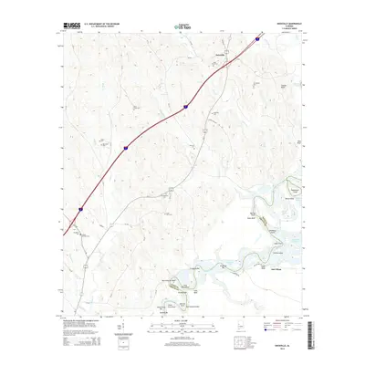
2014 Map of Knoxville
USGS Topo · Published 2014About this map
The Black Warrior River meanders along the southern and eastern edges of this landscape, forming the boundary between Greene and Hale counties. This segment of the river is characterized by complex hydrography, featuring numerous bars and shoals such as Z Loggans Bar, Long Bend Shoal, and Merriweather Reef. Toward the south, Oak Village stands near the riverbanks, where landforms like Logan Bluff and Colvins Island define the shifting shoreline.
Find a feature on this map
67 named features on this map. Tap any name to fly to it.
Don’t see what you’re looking for? This feature index may not catch every label — zoom into the map to look around manually.
Map Details
Editions of this 2014 Knoxville Map
This is the sole edition of this map. No revisions or reprints were ever made.
Other maps of this area

1924 · Tuscaloosa
USGS Topo · 1:62,500

1926 · Tuscaloosa
USGS Topo · 1:62,500

1927 · Eutaw
USGS Topo · 1:48,000

1931 · Eutaw
USGS Topo · 1:62,500

1953 · Montgomery
USGS Topo · 1:250,000

1953 · Birmingham
USGS Topo · 1:250,000

1956 · Birmingham
USGS Topo · 1:250,000

1956 · Montgomery
USGS Topo · 1:250,000

1957 · Birmingham
USGS Topo · 1:250,000

1957 · Montgomery
USGS Topo · 1:250,000