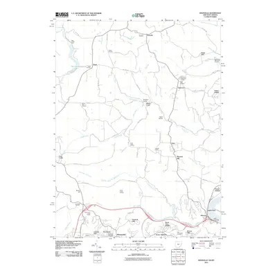
2010 Map of Knoxville
USGS Topo · Published 2010About this map
Wintersville and the surrounding valley of Wills Creek define the southern landscape of this Eastern Ohio region, where modern suburban development meets the historic cemeteries and small settlements of Jefferson County. The map details a high density of local heritage sites, from the expansive Fort Steuben Burial Estates to numerous smaller grounds like Two Ridges Cemetery and Mount Tabor Cemetery. These burial sites, often associated with early Methodist and Presbyterian congregations, provide a clear record of family lineage across the township.
Find a feature on this map
99 named features on this map. Tap any name to fly to it.
Don’t see what you’re looking for? This feature index may not catch every label — zoom into the map to look around manually.
Map Details
Editions of this 2010 Knoxville Map
This is the sole edition of this map. No revisions or reprints were ever made.
Other maps of this area

1901 · Cadiz
USGS Topo · 1:62,500

1903 · Cadiz
USGS Topo · 1:62,500

1904 · Wellsville
USGS Topo · 1:62,500

1904 · Steubenville
USGS Topo · 1:62,500

1905 · Salineville
USGS Topo · 1:62,500

1935 · Steubenville
USGS Topo · 1:62,500

1937 · Wellsville
USGS Topo · 1:62,500

1942 · Steubenville
USGS Topo · 1:62,500

1944 · Wellsville
USGS Topo · 1:62,500

1951 · Canton
USGS Topo · 1:250,000