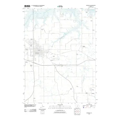
2010 Map of Knoxville
USGS Topo · Published 2010About this map
The city of Knoxville anchors this Marion County landscape, serving as a hub for the surrounding agricultural and coal-mining history. The northern boundary is defined by the significant reach of Lake Red Rock, where the waters of White Breast Creek and other tributaries meet. This 2010 survey reveals a landscape rich in genealogical markers, with over a dozen burial grounds scattered across the township, including Monster Cemetery near the lake shore and Graceland Cemetery within the city limits.
Find a feature on this map
66 named features on this map. Tap any name to fly to it.
Don’t see what you’re looking for? This feature index may not catch every label — zoom into the map to look around manually.
Map Details
Editions of this 2010 Knoxville Map
This is the sole edition of this map. No revisions or reprints were ever made.
Other maps of this area

1909 · Knoxville
USGS Topo · 1:62,500

1910 · Pella
USGS Topo · 1:62,500

1912 · Knoxville
USGS Topo · 1:62,500

1912 · Pella
USGS Topo · 1:62,500

1924 · Melcher
USGS Topo · 1:62,500

1929 · Albia
USGS Topo · 1:62,500

1954 · Des Moines
USGS Topo · 1:250,000

1956 · Des Moines
USGS Topo · 1:250,000

1957 · Des Moines
USGS Topo · 1:250,000

1965 · Knoxville NW
USGS Topo · 1:24,000