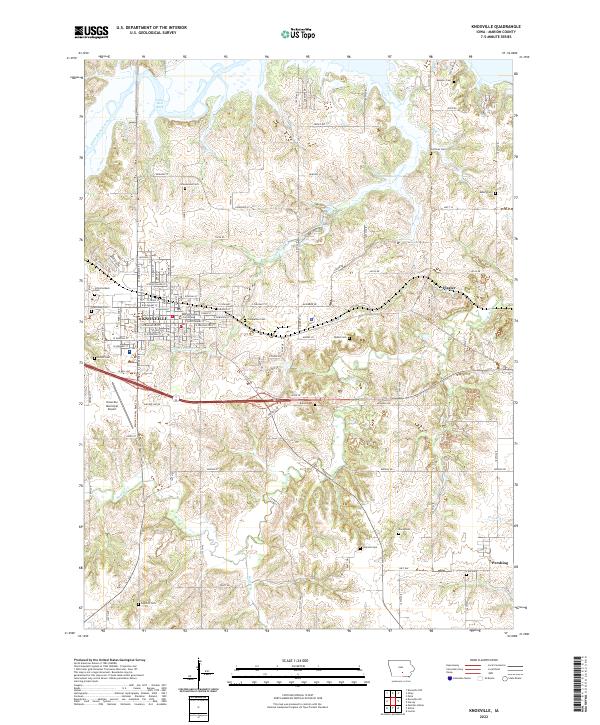
2022 Map of Knoxville
USGS Topo · Published 2022About this map
The Marion County Courthouse stands at the heart of Knoxville, anchor of a rectilinear grid of streets including W Pearl St and W Jefferson St. The town is surrounded by a dense network of family and community burial grounds, from the large Graceland Cem to smaller sites like Schlotterback Cem and DeWitt Cem. This landscape transition from the concentrated county seat to the outlying settlements of Flagler and Pershing is defined by the drainages of English Cr and Competine Creek, which carve through the Iowa terrain toward Lake Red Rock in the north. The presence of the Knoxville Municipal Airport southwest of the city center highlights the modern infrastructure serving this agricultural and civic hub.
Find a feature on this map
111 named features on this map. Tap any name to fly to it.
Don’t see what you’re looking for? This feature index may not catch every label — zoom into the map to look around manually.
Map Details
Editions of this 2022 Knoxville Map
This is the sole edition of this map. No revisions or reprints were ever made.
Other maps of this area

1909 · Knoxville
USGS Topo · 1:62,500

1910 · Pella
USGS Topo · 1:62,500

1912 · Knoxville
USGS Topo · 1:62,500

1912 · Pella
USGS Topo · 1:62,500

1924 · Melcher
USGS Topo · 1:62,500

1929 · Albia
USGS Topo · 1:62,500

1954 · Des Moines
USGS Topo · 1:250,000

1956 · Des Moines
USGS Topo · 1:250,000

1957 · Des Moines
USGS Topo · 1:250,000

1965 · Knoxville NW
USGS Topo · 1:24,000