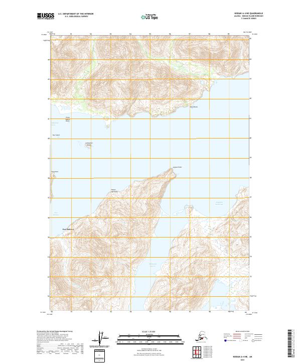
2021 Map of Kodiak A-4 NE
USGS Topo · Published 2021About this map
Sitkalidak Strait separates the dramatic coastal landforms of Kodiak Island in this modern topographic study. The coastline is defined by prominent maritime landmarks such as Three Sisters Rocks, Nut Island, and the distinctive Cathedral Island. Deep inlets provide protected waters, most notably at Port Hobron and Tanginak Anchorage, which suggest a landscape shaped by both geological force and maritime utility. Inland, the terrain rises sharply from the shore, drained by small waterways like Fugitive Cr and characterized by features like McDonald Lagoon near Lagoon Point. The map details a complex interface of sea and land, where points like Fang Point and Harbor Hat Point navigate the transition from the steep Alaskan interior to the Pacific waters.
Find a feature on this map
16 named features on this map. Tap any name to fly to it.
Don’t see what you’re looking for? This feature index may not catch every label — zoom into the map to look around manually.
Map Details
Editions of this 2021 Kodiak A-4 NE Map
This is the sole edition of this map. No revisions or reprints were ever made.
Other maps of this area

1949 · Kodiak A-3
USGS Topo · 1:63,360

1949 · Kodiak B-3
USGS Topo · 1:63,360

1950 · Kodiak A-3
USGS Topo · 1:63,360

1950 · Kodiak B-3
USGS Topo · 1:63,360

1952 · Kodiak
USGS Topo · 1:250,000

1952 · Kodiak B-4
USGS Topo · 1:63,360
1952 · Kodiak A-4
USGS Topo · 1:63,360
1954 · Kodiak A-4
USGS Topo · 1:63,360
1954 · Kodiak B-4
USGS Topo · 1:63,360
2021 · Kodiak A-3 SW
USGS Topo · 1:25,000