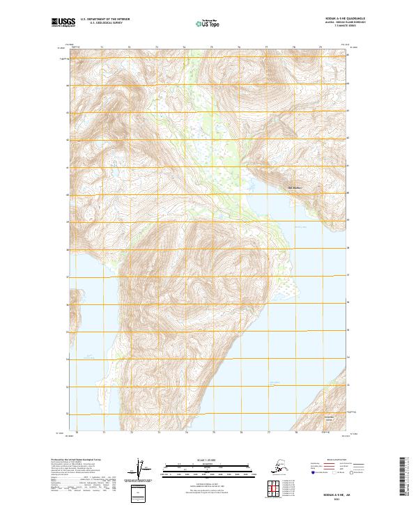
2021 Map of Kodiak A-5 NE
USGS Topo · Published 2021About this map
Old Harbor stands as the primary cultural and residential hub on this portion of Kodiak Island's southeastern coast, situated where the land meets the sheltered waters of Barling Bay. This coastal geography is defined by deep inlets and narrow passages, most notably the Sitkalidak Strait which separates the main island from Sitkalidak Island to the southeast. To the west, the map reaches the shores of Three Saints Bay, an area of immense significance as the site of the first permanent Russian settlement in Alaska in the late 18th century. The topography shown here is dominated by sharp elevation gains immediately inland from the coast, illustrating the geographic isolation that has shaped the maritime economy and traditional Alutiiq way of life in this region. The absence of roads connecting these coastal points underscores the continued reliance on the sea for transport and communication.
Find a feature on this map
9 named features on this map. Tap any name to fly to it.
Don’t see what you’re looking for? This feature index may not catch every label — zoom into the map to look around manually.
Map Details
Editions of this 2021 Kodiak A-5 NE Map
This is the sole edition of this map. No revisions or reprints were ever made.
Other maps of this area

1952 · Kodiak
USGS Topo · 1:250,000

1952 · Kodiak B-5
USGS Topo · 1:63,360

1952 · Kodiak B-4
USGS Topo · 1:63,360
1952 · Kodiak A-5
USGS Topo · 1:63,360
1952 · Kodiak A-4
USGS Topo · 1:63,360
1954 · Kodiak A-4
USGS Topo · 1:63,360
1954 · Kodiak B-4
USGS Topo · 1:63,360
1954 · Kodiak A-5
USGS Topo · 1:63,360
1954 · Kodiak B-5
USGS Topo · 1:63,360
2021 · Kodiak B-5 SW
USGS Topo · 1:25,000