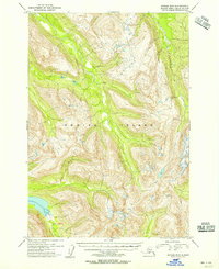
1954 Map of Kodiak B-5
USGS Topo · Published 1955About this map
Kodiak Island topography is the primary focus of this mid-century survey, which reveals a complex landscape defined by high ridges and deep valleys. The entire land area shown is contained within the Kodiak National Wildlife Refuge, highlighting a period of federal management and conservation on the archipelago. Surveyed via aerial photography in the early 1950s, the map provides detailed elevation data for the interior mountains, which rise from coastal basins to summits exceeding 4,000 feet. The absence of named settlements or infrastructure on this sheet emphasizes the wilderness character of the central island interior during the post-war era, as researchers and outdoorsmen began to document the remote reaches of the Alaska-Third Judicial Division.
Find a feature on this map
2 named features on this map. Tap any name to fly to it.
Don’t see what you’re looking for? This feature index may not catch every label — zoom into the map to look around manually.
Map Details
Editions of this 1954 Kodiak B-5 Map
This is the sole edition of this map. No revisions or reprints were ever made.
Other maps of this area

1952 · Kodiak
USGS Topo · 1:250,000

1952 · Kodiak B-6
USGS Topo · 1:63,360

1952 · Kodiak C-4
USGS Topo · 1:63,360

1952 · Kodiak C-5
USGS Topo · 1:63,360

1952 · Kodiak B-5
USGS Topo · 1:63,360

1952 · Kodiak C-6
USGS Topo · 1:63,360

1952 · Kodiak B-4
USGS Topo · 1:63,360

1952 · Kodiak A-6
USGS Topo · 1:63,360
1952 · Kodiak A-5
USGS Topo · 1:63,360
1952 · Kodiak A-4
USGS Topo · 1:63,360