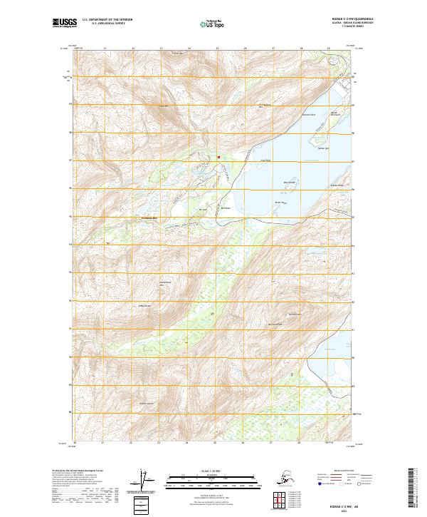
2021 Map of Kodiak C-2 NW
USGS Topo · Published 2021About this map
Womens Bay serves as the central focal point of this coastal landscape, where the Chiniak Highway skirts the shoreline to connect local settlements and remote terrain. The residential area of Bell Flats is situated at the head of the bay, flanked by significant peaks such as Mt Joan and Old Womens Mtn. The map reveals a complex network of waterways, including the American River, Salonie Cr, and Panamaroff Cr, which drain the surrounding highlands of Eddys Range and Kashevaroff Mtn. Inland, numerous small lakes such as Jack Lake, Beaver Lake, and Lake Orbin are scattered through the valleys, illustrating the drainage patterns that define this part of Kodiak Island. The coastal geography is further defined by prominent features like Frye Point, Bruhn Point, and the distinct Nyman Peninsula with its narrow Nyman Spit.
Find a feature on this map
57 named features on this map. Tap any name to fly to it.
Don’t see what you’re looking for? This feature index may not catch every label — zoom into the map to look around manually.
Map Details
Editions of this 2021 Kodiak C-2 NW Map
This is the sole edition of this map. No revisions or reprints were ever made.
Other maps of this area

1947 · Kodiak D-3
USGS Topo · 1:63,360

1949 · Kodiak C-2
USGS Topo · 1:63,360

1949 · Kodiak D-2
USGS Topo · 1:63,360

1949 · Kodiak D-3
USGS Topo · 1:63,360

1950 · Kodiak D-3
USGS Topo · 1:63,360

1951 · Kodiak D-2
USGS Topo · 1:63,360

1952 · Kodiak
USGS Topo · 1:250,000

1952 · Kodiak C-3
USGS Topo · 1:63,360

1954 · Kodiak C-3
USGS Topo · 1:63,360
1987 · Kodiak C-2 NW
USGS Topo · 1:25,000