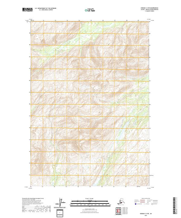
2021 Map of Kodiak C-2 SW
USGS Topo · Published 2021About this map
American River headwaters dominate the northern slopes of this interior landscape on Kodiak Island, where high-elevation contours mark the drainage divides of the Kodiak C-2 SW quadrangle. In the southeast, the Olds River valley begins its descent through the mountains, reflecting the deep glacial carving characteristic of the Alaskan interior. This modern survey, based on elevation data from 2021 and imagery through 2020, documents a nearly pristine wilderness defined by public land survey boundaries like t30s r21w. The lack of road infrastructure or named settlements underscores the island's difficult geography and the preservation of its primary hydrological systems in the early twenty-first century.
Find a feature on this map
8 named features on this map. Tap any name to fly to it.
Don’t see what you’re looking for? This feature index may not catch every label — zoom into the map to look around manually.
Map Details
Editions of this 2021 Kodiak C-2 SW Map
This is the sole edition of this map. No revisions or reprints were ever made.
Other maps of this area

1949 · Kodiak C-2
USGS Topo · 1:63,360

1949 · Kodiak B-1 and B-2
USGS Topo · 1:63,360

1949 · Kodiak B-3
USGS Topo · 1:63,360

1950 · Kodiak B-3
USGS Topo · 1:63,360

1951 · Kodiak B-1 and B-2
USGS Topo · 1:63,360

1952 · Kodiak
USGS Topo · 1:250,000

1952 · Kodiak C-3
USGS Topo · 1:63,360

1954 · Kodiak C-3
USGS Topo · 1:63,360
1987 · Kodiak C-2 NW
USGS Topo · 1:25,000
1987 · Kodiak C-2 NE
USGS Topo · 1:25,000