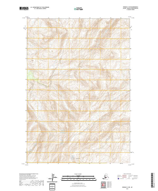
2021 Map of Kodiak C-3 NE
USGS Topo · Published 2021About this map
Center Mtn serves as a central landmark for this mountainous section of Kodiak Island, defined by its steep drainages and glacial topography. This 2021 survey illustrates a wilderness landscape where water flows through primary arteries like Russian Cr and Salonie Cr, which carve through the southern reaches of the quadrangle. In the northern sections, Elbow Cr and Sargent Cr manage the runoff from high-elevation ridgelines. The map is primarily organized by the Public Land Survey System, including portions of t28s r22w, t28s r21w, t29s r22w, and t29s r21w. The absence of developed roads or settlements highlights the remote character of this terrain, making the map a essential resource for understanding the hydrologic patterns and land boundaries in a region where natural features dictate human navigation.
Find a feature on this map
9 named features on this map. Tap any name to fly to it.
Don’t see what you’re looking for? This feature index may not catch every label — zoom into the map to look around manually.
Map Details
Editions of this 2021 Kodiak C-3 NE Map
This is the sole edition of this map. No revisions or reprints were ever made.
Other maps of this area

1947 · Kodiak D-3
USGS Topo · 1:63,360

1949 · Kodiak C-2
USGS Topo · 1:63,360

1949 · Kodiak D-2
USGS Topo · 1:63,360

1949 · Kodiak D-3
USGS Topo · 1:63,360

1950 · Kodiak D-3
USGS Topo · 1:63,360

1951 · Kodiak D-2
USGS Topo · 1:63,360

1952 · Kodiak
USGS Topo · 1:250,000

1952 · Kodiak C-3
USGS Topo · 1:63,360

1954 · Kodiak C-3
USGS Topo · 1:63,360
1987 · Kodiak C-2 NW
USGS Topo · 1:25,000