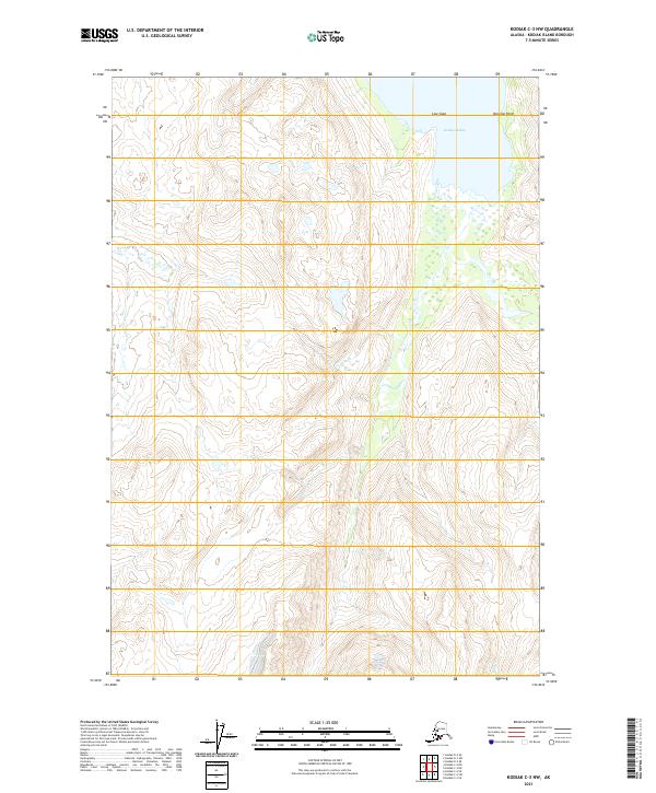
2021 Map of Kodiak C-3 NW
USGS Topo · Published 2021About this map
Kizhuyak Bay dominates the northeast corner of this terrain, where the sea meets the northern coast of Kodiak Island. The landscape is defined by the sharp transition from the tidal waters at Dovolno Point and Low Cape to the steep, high-elevation ridges that rise inland. These interior peaks are dissected by deep drainage patterns, most notably around Wild Cr in the southeast. This 2021 survey by the U.S. Geological Survey provides a precise view of the Public Land Survey System boundaries, including t28s r23w and t29s r23w, reflecting how these remote stretches of the Alaska Kodiak Island Borough are partitioned even in areas without established road networks.
Find a feature on this map
8 named features on this map. Tap any name to fly to it.
Don’t see what you’re looking for? This feature index may not catch every label — zoom into the map to look around manually.
Map Details
Editions of this 2021 Kodiak C-3 NW Map
This is the sole edition of this map. No revisions or reprints were ever made.
Other maps of this area

1947 · Kodiak D-3
USGS Topo · 1:63,360

1949 · Kodiak D-3
USGS Topo · 1:63,360

1950 · Kodiak D-3
USGS Topo · 1:63,360

1952 · Kodiak
USGS Topo · 1:250,000

1952 · Kodiak C-3
USGS Topo · 1:63,360

1952 · Kodiak C-4
USGS Topo · 1:63,360

1952 · Kodiak D-4
USGS Topo · 1:63,360

1954 · Kodiak C-3
USGS Topo · 1:63,360
1954 · Kodiak C-4
USGS Topo · 1:63,360
1954 · Kodiak D-4
USGS Topo · 1:63,360