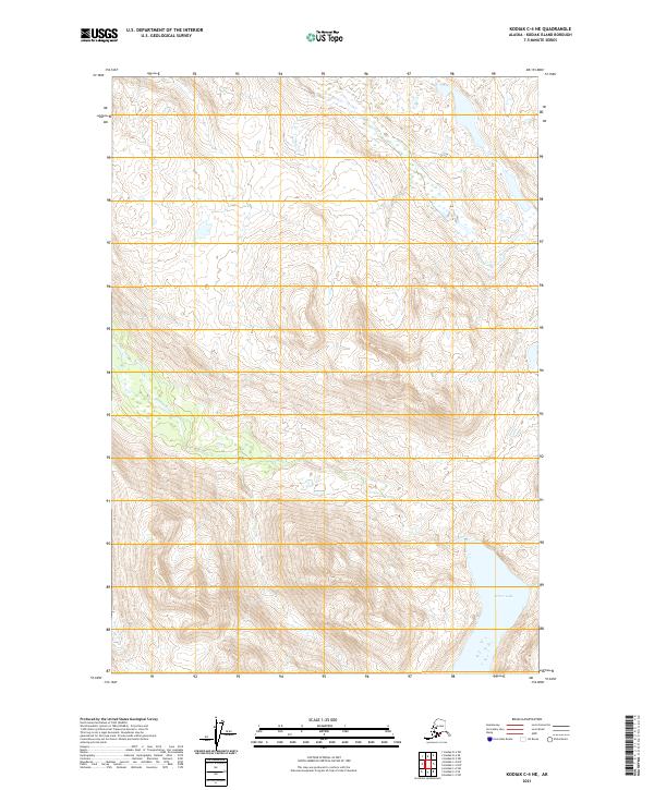
2021 Map of Kodiak C-4 NE
USGS Topo · Published 2021About this map
Terror River winds through the steep, glacially carved valleys of northern Kodiak Island, draining into the expansive Terror Lake. This 2021 topographic study illustrates the complex drainage patterns and elevation profiles of the Kodiak Island Borough, where deep freshwater basins are separated by sharp ridge lines. The map reveals the township and range boundaries of t28s r24w, t28s r23w, t29s r24w, and t29s r23w, marking the administrative divisions across this uninhabited wilderness. The landscape is defined by its dramatic relief, where narrow watercourses feed into the central reservoir, providing a modern look at the island's interior hydrography.
Find a feature on this map
6 named features on this map. Tap any name to fly to it.
Don’t see what you’re looking for? This feature index may not catch every label — zoom into the map to look around manually.
Map Details
Editions of this 2021 Kodiak C-4 NE Map
This is the sole edition of this map. No revisions or reprints were ever made.
Other maps of this area

1947 · Kodiak D-3
USGS Topo · 1:63,360

1949 · Kodiak D-3
USGS Topo · 1:63,360

1950 · Kodiak D-3
USGS Topo · 1:63,360

1952 · Kodiak
USGS Topo · 1:250,000

1952 · Kodiak C-3
USGS Topo · 1:63,360

1952 · Kodiak C-4
USGS Topo · 1:63,360

1952 · Kodiak D-4
USGS Topo · 1:63,360

1954 · Kodiak C-3
USGS Topo · 1:63,360
1954 · Kodiak C-4
USGS Topo · 1:63,360
1954 · Kodiak D-4
USGS Topo · 1:63,360