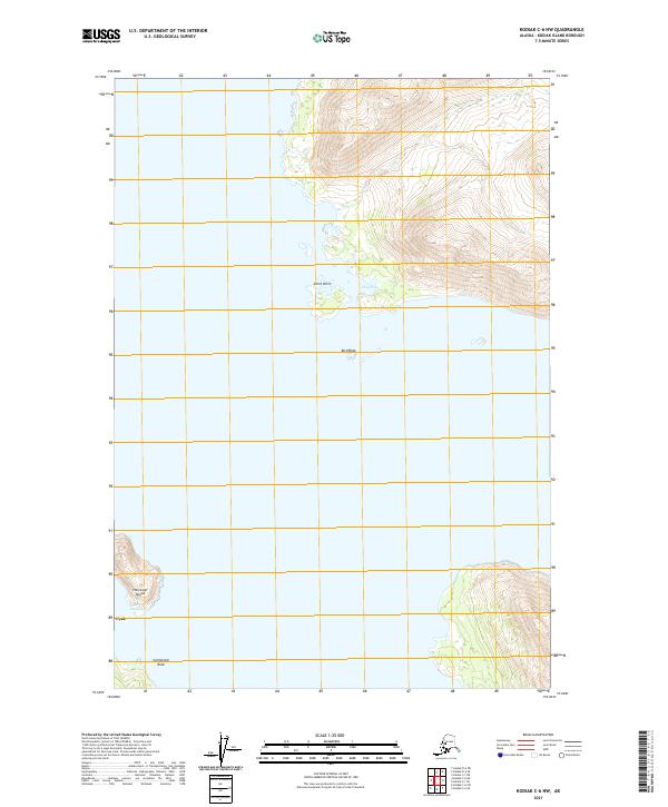
2021 Map of Kodiak C-6 NW
USGS Topo · Published 2021About this map
Uyak Anchorage serves as a protected maritime corridor between the mainland of Kodiak Island and Harvester Island on this 2021 topographic sheet. The map focuses on the complex shoreline where the coastal settlement of Uyak is situated at the foot of steep elevation changes. To the north, the terrain extends to Chief Point and the sheltered waters of Chief Cove, providing a detailed look at the island’s jagged northwestern coastline. The presence of small maritime hazards like Bird Rock and Cormorant Rock emphasizes the navigational character of this region. This modern survey, produced by the U.S. Geological Survey, uses precise contours and satellite imagery to document the interface of land and sea in a region defined by its reliance on water-based transit and remote coastal outposts.
Find a feature on this map
11 named features on this map. Tap any name to fly to it.
Don’t see what you’re looking for? This feature index may not catch every label — zoom into the map to look around manually.
Map Details
Editions of this 2021 Kodiak C-6 NW Map
This is the sole edition of this map. No revisions or reprints were ever made.
Other maps of this area

1951 · Karluk
USGS Topo · 1:250,000

1951 · Kodiak D-6
USGS Topo · 1:63,360

1952 · Kodiak
USGS Topo · 1:250,000

1952 · Karluk
USGS Topo · 1:250,000

1952 · Karluk C-1
USGS Topo · 1:63,360

1952 · Kodiak C-6
USGS Topo · 1:63,360
1954 · Kodiak C-6
USGS Topo · 1:63,360
1954 · Karluk C-1
USGS Topo · 1:63,360
1954 · Kodiak D-6
USGS Topo · 1:63,360

1964 · Karluk
USGS Topo · 1:250,000