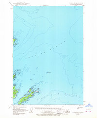
1949 Map of Kodiak D-1
USGS Topo · Published 1968About this map
The maritime approaches to Kodiak Island are defined by a complex archipelago and dangerous offshore hazards as they appeared in the late 1940s. Centered on the meeting of the Gulf of Alaska and the Pacific Ocean, this chart details the significant islands guarding the harbor entrance, including the substantial landmasses of Woody Island and Long Island. These islands are marked by freshwater features like Elephant Lake and Dolgoi Lake, which stood in contrast to the surrounding saltwater bays. Navigation aids and maritime safety are prominent themes, evidenced by the presence of Hanin Rocks Light and several hazardous shoals like Williams Reef and Hutchinson Reef. The map also captures early telecommunications infrastructure with Radio Towers located near the northern coast of Woody Island, while the shoreline of Spruce I to the north shows landforms like East Cape and Ostrof Point.
Find a feature on this map
24 named features on this map. Tap any name to fly to it.
Don’t see what you’re looking for? This feature index may not catch every label — zoom into the map to look around manually.
Map Details
Editions of this 1949 Kodiak D-1 Map
2 editions found
Other maps of this area

1949 · Kodiak C-2
USGS Topo · 1:63,360

1949 · Kodiak D-2
USGS Topo · 1:63,360

1949 · Kodiak C-1
USGS Topo · 1:63,360

1949 · Kodiak D-1
USGS Topo · 1:63,360

1951 · Kodiak D-1
USGS Topo · 1:63,360

1951 · Kodiak D-2
USGS Topo · 1:63,360

1951 · Kodiak C-1
USGS Topo · 1:63,360

1952 · Kodiak
USGS Topo · 1:250,000

1952 · Afognak
USGS Topo · 1:250,000

1952 · Afognak A-1
USGS Topo · 1:63,360