
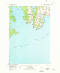
1952 Map of Afognak A-1
USGS Topo · Published 1967About this map
Afognak Island reveals a complex network of deep-water inlets and high coastal ridges in this 1950s study. The terrain is dominated by Edge Mountain, which overlooks the eastern coastline where King Cove and Tonki Bay indent the land. This entire land area is contained within the Chugach National Forest, emphasizing its status as protected wilderness during this era.
Find a feature on this map
26 named features on this map. Tap any name to fly to it.
Don’t see what you’re looking for? This feature index may not catch every label — zoom into the map to look around manually.
Map Details
Editions of this 1952 Afognak A-1 Map
3 editions found
Other maps of this area

1949 · Kodiak D-2
USGS Topo · 1:63,360

1949 · Kodiak D-1
USGS Topo · 1:63,360

1951 · Kodiak D-1
USGS Topo · 1:63,360

1951 · Kodiak D-2
USGS Topo · 1:63,360

1952 · Kodiak
USGS Topo · 1:250,000

1952 · Afognak
USGS Topo · 1:250,000

1952 · Afognak A-2
USGS Topo · 1:63,360

1952 · Afognak B-2
USGS Topo · 1:63,360

1952 · Afognak B-1
USGS Topo · 1:63,360
1952 · Afognak A-0 and B-0
USGS Topo · 1:63,360