
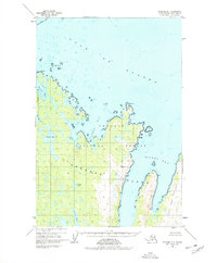
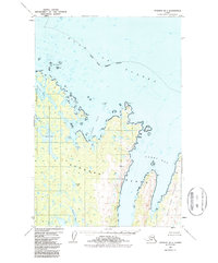
1952 Map of Afognak B-1
USGS Topo · Published 1971About this map
Chugach National Forest boundaries encompass much of this coastal landscape on the northeastern portion of Afognak Island. In the early 1950s, the coastline was defined by deep indentations like Seal Bay and Tonki Bay, separating the mainland from the prominent Tonki Peninsula. The presence of Cabins near the western shore of Pauls Lake suggests localized seasonal or subsistence activity, perhaps for fishing or hunting, in an otherwise largely unpopulated wilderness. Moving inland, the topography is characterized by numerous freshwater bodies such as Laura Lake and Gretchen Lake. The map reveals a rugged maritime environment where prominent headlands like Tolstoi Pt and Posliedni Pt face the open waters of the Gulf of Alaska, while offshore hazards like Seal Islands and Vantage Rock dot the coastal approaches.
Find a feature on this map
18 named features on this map. Tap any name to fly to it.
Don’t see what you’re looking for? This feature index may not catch every label — zoom into the map to look around manually.
Map Details
Editions of this 1952 Afognak B-1 Map
3 editions found
Other maps of this area

1952 · Afognak
USGS Topo · 1:250,000

1952 · Afognak C-1 and C-2
USGS Topo · 1:63,360

1952 · Afognak A-1
USGS Topo · 1:63,360

1952 · Afognak A-2
USGS Topo · 1:63,360

1952 · Afognak B-2
USGS Topo · 1:63,360
1952 · Afognak A-0 and B-0
USGS Topo · 1:63,360
1953 · Afognak A-1
USGS Topo · 1:63,360
1953 · Afognak A-0 and B-0
USGS Topo · 1:63,360

1954 · Afognak B-2
USGS Topo · 1:63,360
1954 · Afognak A-2
USGS Topo · 1:63,360