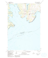
1952 Map of Afognak A-1
USGS Topo · Published 1992About this map
Afognak Island reveals its jagged eastern shoreline in this 1952 study, defined by deep indentations and prominent headlands. The terrain is dominated by the heights of Edge Mountain, which overlooks the convergence of Tonki Bay and King Cove. This area of the Kodiak Island Borough is largely preserved within the overlapping boundaries of the Chugach National Forest and the Kodiak National Wildlife Refuge. The map details a complex maritime environment where Izhut Bay and Marmot Bay meet, providing critical data on depth curves and shoreline features such as Pillar Cape and Peril Cape. This data, compiled from aerial photography and hydrographic charts of the early 1950s, documents the coastal character of the region before modern development or environmental shifts.
Find a feature on this map
13 named features on this map. Tap any name to fly to it.
Don’t see what you’re looking for? This feature index may not catch every label — zoom into the map to look around manually.
Map Details
Editions of this 1952 Afognak A-1 Map
3 editions found
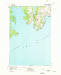
Other maps of this area

1949 · Kodiak D-2
USGS Topo · 1:63,360

1949 · Kodiak D-1
USGS Topo · 1:63,360

1951 · Kodiak D-1
USGS Topo · 1:63,360

1951 · Kodiak D-2
USGS Topo · 1:63,360

1952 · Kodiak
USGS Topo · 1:250,000

1952 · Afognak
USGS Topo · 1:250,000

1952 · Afognak A-1
USGS Topo · 1:63,360

1952 · Afognak A-2
USGS Topo · 1:63,360

1952 · Afognak B-2
USGS Topo · 1:63,360

1952 · Afognak B-1
USGS Topo · 1:63,360