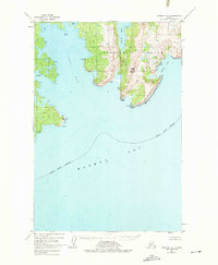
1952 Map of Afognak A-1
USGS Topo · Published 1975About this map
Afognak Island defines this coastal study, situated within the Kodiak Island Borough and the protected boundaries of the Chugach National Forest. The map, based on 1951-1952 aerial photography, documents a complex maritime landscape dominated by Izhut Bay and the deep indentations of Tonki Bay and Saposa Bay. These waters were vital for the region's fishing and maritime transport long before modern infrastructure reached this part of Alaska.
Find a feature on this map
12 named features on this map. Tap any name to fly to it.
Don’t see what you’re looking for? This feature index may not catch every label — zoom into the map to look around manually.
Map Details
Editions of this 1952 Afognak A-1 Map
3 editions found
Other maps of this area

1949 · Kodiak D-2
USGS Topo · 1:63,360

1949 · Kodiak D-1
USGS Topo · 1:63,360

1951 · Kodiak D-1
USGS Topo · 1:63,360

1951 · Kodiak D-2
USGS Topo · 1:63,360

1952 · Kodiak
USGS Topo · 1:250,000

1952 · Afognak
USGS Topo · 1:250,000

1952 · Afognak A-1
USGS Topo · 1:63,360

1952 · Afognak A-2
USGS Topo · 1:63,360

1952 · Afognak B-2
USGS Topo · 1:63,360

1952 · Afognak B-1
USGS Topo · 1:63,360