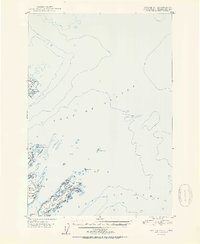
1951 Map of Kodiak D-1
USGS Topo · Published 1951About this map
Woody Island and the surrounding waters of the Pacific Ocean define this maritime landscape northeast of Kodiak. The 1951 survey reveals a cluster of coastal landmarks and navigational hazards, including the prominent Radio Towers on the western shore of Woody Island. Small interior bodies of water like Elephant Lake contrast with the exposed marine environment of the Gulf of Alaska.
Find a feature on this map
23 named features on this map. Tap any name to fly to it.
Don’t see what you’re looking for? This feature index may not catch every label — zoom into the map to look around manually.
Map Details
Editions of this 1951 Kodiak D-1 Map
2 editions found
Other maps of this area

1949 · Kodiak C-2
USGS Topo · 1:63,360

1949 · Kodiak D-2
USGS Topo · 1:63,360

1949 · Kodiak C-1
USGS Topo · 1:63,360

1949 · Kodiak D-1
USGS Topo · 1:63,360

1951 · Kodiak D-1
USGS Topo · 1:63,360

1951 · Kodiak D-2
USGS Topo · 1:63,360

1951 · Kodiak C-1
USGS Topo · 1:63,360

1952 · Kodiak
USGS Topo · 1:250,000

1952 · Afognak
USGS Topo · 1:250,000

1952 · Afognak A-1
USGS Topo · 1:63,360