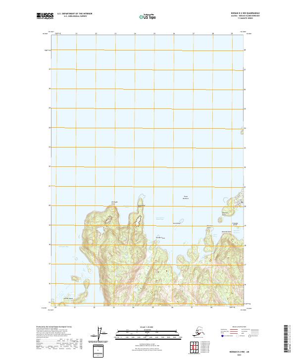
2021 Map of Kodiak D-2 NW
USGS Topo · Published 2021About this map
Kizhuyak Bay and its complex network of rocky points and sheltered coves dominate the northern reaches of Kodiak Island in this contemporary survey. The coastline is defined by several significant maritime landmarks, including the prominent Kizhuyak Point and Shakmanof Point, which shelter the quiet waters of Shakmanof Cove. To the east, the topography narrows toward the settlement of Ouzinkie, marked by a cluster of streets including 5th Street and Third Street that descend toward the shoreline.
Find a feature on this map
23 named features on this map. Tap any name to fly to it.
Don’t see what you’re looking for? This feature index may not catch every label — zoom into the map to look around manually.
Map Details
Editions of this 2021 Kodiak D-2 NW Map
This is the sole edition of this map. No revisions or reprints were ever made.
Other maps of this area

1947 · Kodiak D-3
USGS Topo · 1:63,360

1949 · Kodiak D-2
USGS Topo · 1:63,360

1949 · Kodiak D-3
USGS Topo · 1:63,360

1950 · Kodiak D-3
USGS Topo · 1:63,360

1951 · Kodiak D-2
USGS Topo · 1:63,360

1952 · Kodiak
USGS Topo · 1:250,000

1952 · Afognak
USGS Topo · 1:250,000

1952 · Afognak A-3
USGS Topo · 1:63,360

1952 · Afognak A-2
USGS Topo · 1:63,360
1954 · Afognak A-2
USGS Topo · 1:63,360