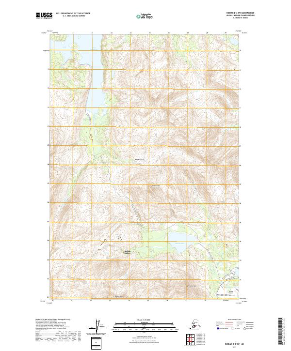
2021 Map of Kodiak D-2 SW
USGS Topo · Published 2021About this map
Kodiak Island is dominated by dramatic elevation changes and essential coastal infrastructure in this modern survey. The map centers on the high peaks of Pyramid Mtn, Barometer Mtn, and Erskine Mtn, which define the interior topography south of Anton Larsen Bay. The coastal corridor near the Kodiak Airport shows a concentrated network of transportation and settlement, where Anton Larsen Bay Road and Rezanof Drive provide the primary terrestrial connections for Kodiak Station.
Find a feature on this map
23 named features on this map. Tap any name to fly to it.
Don’t see what you’re looking for? This feature index may not catch every label — zoom into the map to look around manually.
Map Details
Editions of this 2021 Kodiak D-2 SW Map
This is the sole edition of this map. No revisions or reprints were ever made.
Other maps of this area

1947 · Kodiak D-3
USGS Topo · 1:63,360

1949 · Kodiak C-2
USGS Topo · 1:63,360

1949 · Kodiak D-2
USGS Topo · 1:63,360

1949 · Kodiak D-3
USGS Topo · 1:63,360

1950 · Kodiak D-3
USGS Topo · 1:63,360

1951 · Kodiak D-2
USGS Topo · 1:63,360

1952 · Kodiak
USGS Topo · 1:250,000

1952 · Kodiak C-3
USGS Topo · 1:63,360

1954 · Kodiak C-3
USGS Topo · 1:63,360
1987 · Kodiak C-2 NW
USGS Topo · 1:25,000