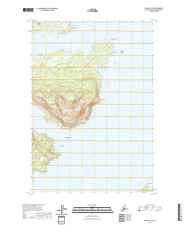
2021 Map of Kodiak D-3 NE
USGS Topo · Published 2021About this map
Whale Island dominates this maritime survey, situated where the waters of Whale Passage and the Afognak Strait meet. Rising steeply from the sea, the island's interior is defined by sharp elevation changes, culminating at Orient Point and Dirovati Point on its eastern shore. To the north, the southern tip of Afognak Island is visible across the strait, featuring Back Bay and Afognak Point.
Find a feature on this map
28 named features on this map. Tap any name to fly to it.
Don’t see what you’re looking for? This feature index may not catch every label — zoom into the map to look around manually.
Map Details
Editions of this 2021 Kodiak D-3 NE Map
This is the sole edition of this map. No revisions or reprints were ever made.
Other maps of this area

1947 · Kodiak D-3
USGS Topo · 1:63,360

1949 · Kodiak D-2
USGS Topo · 1:63,360

1949 · Kodiak D-3
USGS Topo · 1:63,360

1950 · Kodiak D-3
USGS Topo · 1:63,360

1951 · Kodiak D-2
USGS Topo · 1:63,360

1952 · Kodiak
USGS Topo · 1:250,000

1952 · Afognak
USGS Topo · 1:250,000

1952 · Afognak A-3
USGS Topo · 1:63,360

1952 · Afognak A-2
USGS Topo · 1:63,360
1954 · Afognak A-2
USGS Topo · 1:63,360