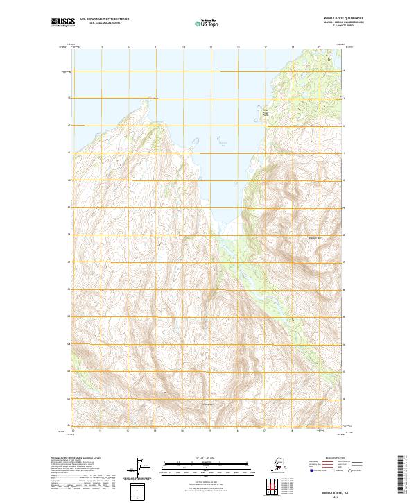
2021 Map of Kodiak D-3 SE
USGS Topo · Published 2021About this map
Sharatin Bay dominates the northern coast of this Kodiak Island landscape, carved by deep inlets and steep coastal elevations. The terrain is defined by dramatic peaks such as Sharatin Mtn to the east and Elbow Mtn to the south, which overlook the drainage basin of Elbow Creek. The shoreline is marked by prominent maritime landmarks including Kekur Point and the distinctively named Three Pillar Point, which extends into the bay. This 2021 topographic study by the U.S. Geological Survey illustrates a wild, unsettled coastal environment where the land meets the sea through a series of ridges and glacial valleys, showing no modern road infrastructure or permanent settlements within these specific township boundaries.
Find a feature on this map
13 named features on this map. Tap any name to fly to it.
Don’t see what you’re looking for? This feature index may not catch every label — zoom into the map to look around manually.
Map Details
Editions of this 2021 Kodiak D-3 SE Map
This is the sole edition of this map. No revisions or reprints were ever made.
Other maps of this area

1947 · Kodiak D-3
USGS Topo · 1:63,360

1949 · Kodiak C-2
USGS Topo · 1:63,360

1949 · Kodiak D-2
USGS Topo · 1:63,360

1949 · Kodiak D-3
USGS Topo · 1:63,360

1950 · Kodiak D-3
USGS Topo · 1:63,360

1951 · Kodiak D-2
USGS Topo · 1:63,360

1952 · Kodiak
USGS Topo · 1:250,000

1952 · Kodiak C-3
USGS Topo · 1:63,360

1954 · Kodiak C-3
USGS Topo · 1:63,360
1987 · Kodiak C-2 NW
USGS Topo · 1:25,000