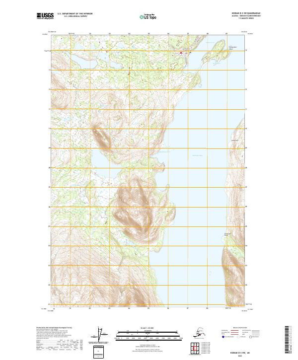
2021 Map of Kodiak D-3 SW
USGS Topo · Published 2021About this map
Port Wakefield sits at the northern edge of this coastal landscape on Kodiak Island, where the sheltered waters of Settler Cove meet the expansive Kizhuyak Bay. The terrain is defined by dramatic coastal features, including the prominent Peregrebi Point guarding the cove and the southern reaches of Barabara Cove. A modest network of local infrastructure is concentrated near the settlement, featuring Airport Road, Harbor Road, and Dam Road, which suggest a community tied closely to maritime activities and local transit. Farther south along the shoreline, the map identifies distinct markers such as Leto Point and Pestchani Point, illustrating the detailed nomenclature of this remote Alaskan shoreline during the early twenty-first century.
Find a feature on this map
20 named features on this map. Tap any name to fly to it.
Don’t see what you’re looking for? This feature index may not catch every label — zoom into the map to look around manually.
Map Details
Editions of this 2021 Kodiak D-3 SW Map
This is the sole edition of this map. No revisions or reprints were ever made.
Other maps of this area

1947 · Kodiak D-3
USGS Topo · 1:63,360

1949 · Kodiak D-3
USGS Topo · 1:63,360

1950 · Kodiak D-3
USGS Topo · 1:63,360

1952 · Kodiak
USGS Topo · 1:250,000

1952 · Kodiak C-3
USGS Topo · 1:63,360

1952 · Kodiak C-4
USGS Topo · 1:63,360

1952 · Kodiak D-4
USGS Topo · 1:63,360

1954 · Kodiak C-3
USGS Topo · 1:63,360
1954 · Kodiak C-4
USGS Topo · 1:63,360
1954 · Kodiak D-4
USGS Topo · 1:63,360