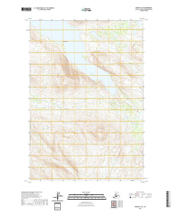
2021 Map of Kodiak D-4 SE
USGS Topo · Published 2021About this map
Rolling Point defines the western shoreline of a prominent inland water body on this remote portion of Kodiak Island. The landscape is characterized by significant elevation changes, with steep slopes rising from the water to peaks exceeding 2,000 feet. This 2021 update by the U.S. Geological Survey utilizes high-resolution data to delineate the intricate topography and wetland patterns of the region. The map provides a precise look at the township and range divisions, specifically covering portions of t27s r24w and t27s r23w. The lack of named roads or settlements emphasizes the undeveloped character of this interior island terrain, where natural landmarks like Rolling Point serve as primary points of orientation.
Find a feature on this map
7 named features on this map. Tap any name to fly to it.
Don’t see what you’re looking for? This feature index may not catch every label — zoom into the map to look around manually.
Map Details
Editions of this 2021 Kodiak D-4 SE Map
This is the sole edition of this map. No revisions or reprints were ever made.
Other maps of this area

1947 · Kodiak D-3
USGS Topo · 1:63,360

1949 · Kodiak D-3
USGS Topo · 1:63,360

1950 · Kodiak D-3
USGS Topo · 1:63,360

1952 · Kodiak
USGS Topo · 1:250,000

1952 · Kodiak C-3
USGS Topo · 1:63,360

1952 · Kodiak C-4
USGS Topo · 1:63,360

1952 · Kodiak D-4
USGS Topo · 1:63,360

1954 · Kodiak C-3
USGS Topo · 1:63,360
1954 · Kodiak C-4
USGS Topo · 1:63,360
1954 · Kodiak D-4
USGS Topo · 1:63,360