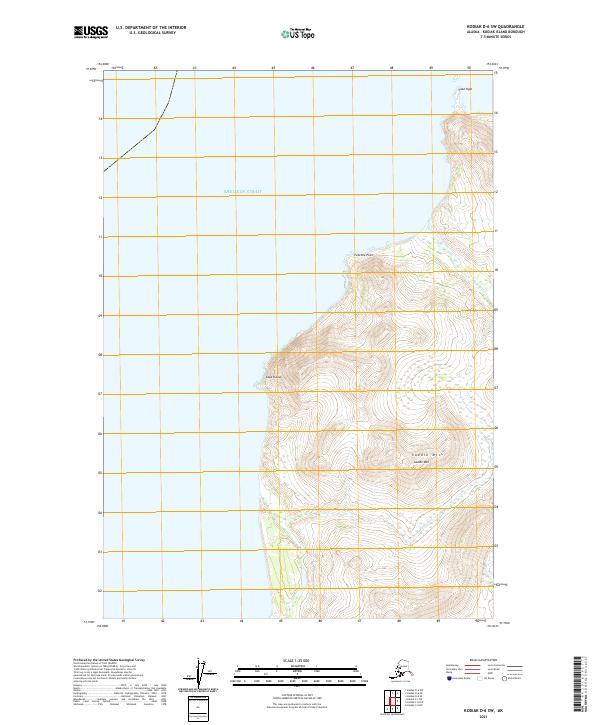
2021 Map of Kodiak D-6 SW
USGS Topo · Published 2021About this map
The western coastline of Kodiak Island meets the expansive Shelikof Strait in this topographical study. The shoreline is defined by sharp geographical markers such as Cape Uyak in the north and the prominent Cape Kuliuk further south. Between these coastal points, the interior rises sharply toward the interior summits, dominated by the peak of Saddle Mtn. The hydrology of the region is characterized by short, steep drainage systems, most notably Little River, which flows through the eastern portion of the terrain before reaching the sea. This landscape remains largely undeveloped, showcasing the raw coastal topography of the Alaska maritime environment. The survey provides precise details on elevations and landform contours, illustrating the transition from the marine environment of the strait to the high ridgelines at Twocone Point.
Find a feature on this map
11 named features on this map. Tap any name to fly to it.
Don’t see what you’re looking for? This feature index may not catch every label — zoom into the map to look around manually.
Map Details
Editions of this 2021 Kodiak D-6 SW Map
This is the sole edition of this map. No revisions or reprints were ever made.
Other maps of this area

1951 · Karluk
USGS Topo · 1:250,000

1951 · Kodiak D-6
USGS Topo · 1:63,360

1952 · Kodiak
USGS Topo · 1:250,000

1952 · Karluk
USGS Topo · 1:250,000

1952 · Karluk C-1
USGS Topo · 1:63,360

1952 · Kodiak C-6
USGS Topo · 1:63,360
1954 · Kodiak C-6
USGS Topo · 1:63,360
1954 · Karluk C-1
USGS Topo · 1:63,360
1954 · Kodiak D-6
USGS Topo · 1:63,360

1964 · Karluk
USGS Topo · 1:250,000