
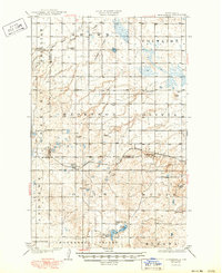
1929 Map of Kongsberg
USGS Topo · Published 1929About this map
Kongsberg and Ruso anchor this 1920s survey of the central North Dakota prairie, where the Minneapolis St Paul and Sault Ste Marie railroad cuts a diagonal path through the glacial terrain. The landscape is defined by the transitions between McHenry, McLean, and Ward counties, marked by numerous small kettle lakes and depressions such as Otis Lake and Strawberry Lake. High points like Dogden Butte and Little Butte provide orientation in an otherwise undulating expanse of Brown, Otis, and Butte townships.
Find a feature on this map
33 named features on this map. Tap any name to fly to it.
Don’t see what you’re looking for? This feature index may not catch every label — zoom into the map to look around manually.
Map Details
Editions of this 1929 Kongsberg Map
2 editions found
Other maps of this area

1929 · Sawyer
USGS Topo · 1:62,500

1929 · Coleharbor
USGS Topo · 1:62,500

1929 · Benedict
USGS Topo · 1:62,500

1929 · Balfour
USGS Topo · 1:62,500

1945 · Pelican Lake
USGS Topo · 1:62,500

1947 · Pelican Lake
USGS Topo · 1:62,500

1947 · Turtle Lake
USGS Topo · 1:62,500

1948 · Voltaire
USGS Topo · 1:24,000

1948 · Velva
USGS Topo · 1:62,500

1948 · Sawyer
USGS Topo · 1:24,000