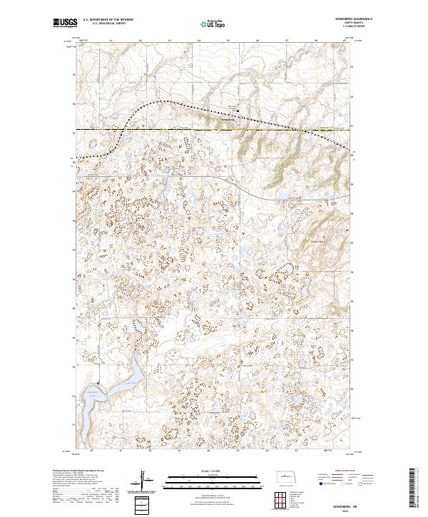
2024 Map of Kongsberg
USGS Topo · Published 2024About this map
The small community of Kongsberg sits at the intersection of local township roads, serving as a quiet anchor in this prairie landscape. Nearby, the Saint John Lutheran Cem offers a primary point of interest for genealogists tracing families from this pocket of North Dakota. The terrain is defined by glacial potholes and wetlands, heavily managed for conservation through the Camp Lake National Wildlife Refuge and the McLean County Waterfowl Production Area. These protected zones surround bodies of water like Strawberry Lake and Camp Lake, while Dogden Butte rises to the east as a prominent topographic landmark. The map detail reflects a section-line road grid typical of the Great Plains, where long stretches like 30th St N connect remote farmsteads and agricultural tracts across the McHenry and McLean county line.
Find a feature on this map
23 named features on this map. Tap any name to fly to it.
Don’t see what you’re looking for? This feature index may not catch every label — zoom into the map to look around manually.
Map Details
Editions of this 2024 Kongsberg Map
This is the sole edition of this map. No revisions or reprints were ever made.
Other maps of this area

1929 · Kongsberg
USGS Topo · 1:62,500

1929 · Balfour
USGS Topo · 1:62,500

1945 · Pelican Lake
USGS Topo · 1:62,500

1947 · Pelican Lake
USGS Topo · 1:62,500

1947 · Turtle Lake
USGS Topo · 1:62,500

1954 · McClusky
USGS Topo · 1:250,000

1958 · McClusky
USGS Topo · 1:250,000

1958 · Butte
USGS Topo · 1:24,000
1958 · Kongsberg NE
USGS Topo · 1:24,000
1958 · Balfour NW
USGS Topo · 1:24,000