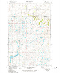
1981 Map of Kongsberg
USGS Topo · Published 1982About this map
Kongsberg sits at the northern edge of this North Dakota landscape, a prairie settlement defined by the presence of St Johns Ch and the throughline of the Soo Line railroad. This 1981 survey illustrates the prairie pothole region at the boundary of McHenry and McLean Counties, where the terrain is dominated by hundreds of small wetlands and larger bodies like Strawberry Lake and Camp Lake. The southern portion of the quadrangle is largely dedicated to conservation, including the Camp Lake National Wildlife Refuge and a National Waterfowl Production Area. Dramatic elevations rise from the flatlands at Dogden Butte, a prominent landmark that serves as a site for several Radio Towers. The map also captures local place names such as Horseshoe Valley, Aurena, and Olivia, providing a clear view of the rural geography and drainage patterns of the era.
Find a feature on this map
20 named features on this map. Tap any name to fly to it.
Don’t see what you’re looking for? This feature index may not catch every label — zoom into the map to look around manually.
Map Details
Editions of this 1981 Kongsberg Map
This is the sole edition of this map. No revisions or reprints were ever made.
Other maps of this area

1929 · Kongsberg
USGS Topo · 1:62,500

1929 · Balfour
USGS Topo · 1:62,500

1945 · Pelican Lake
USGS Topo · 1:62,500

1947 · Pelican Lake
USGS Topo · 1:62,500

1947 · Turtle Lake
USGS Topo · 1:62,500

1954 · McClusky
USGS Topo · 1:250,000

1958 · McClusky
USGS Topo · 1:250,000

1958 · Butte
USGS Topo · 1:24,000
1958 · Kongsberg NE
USGS Topo · 1:24,000
1958 · Balfour NW
USGS Topo · 1:24,000