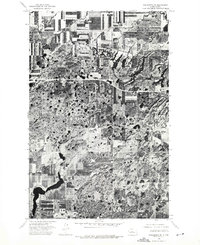
1974 Map of Kongsberg SE
USGS Topo · Published 1975About this map
Agricultural patterns and high-prairie wetlands dominate this orthophotoquad of central North Dakota in the mid-1970s. The small settlement of Kongsberg sits in the northern portion of the map, surrounded by a complex system of pothole lakes and glacial depressions that characterize this region of McLean County. This 1974 aerial survey, produced in cooperation with the State Water Commission in Bismarck, provides a visual record of the land before modern center-pivot irrigation became ubiquitous. The imagery clearly delineates the division between cultivated rectangular fields and the erratic, water-carved terrain of the Missouri Coteau, where numerous small basins and larger dark water bodies punctuate the landscape.
Find a feature on this map
1 named feature on this map. Tap any name to fly to it.
Don’t see what you’re looking for? This feature index may not catch every label — zoom into the map to look around manually.
Map Details
Editions of this 1974 Kongsberg SE Map
This is the sole edition of this map. No revisions or reprints were ever made.
Other maps of this area

1929 · Kongsberg
USGS Topo · 1:62,500

1929 · Balfour
USGS Topo · 1:62,500

1945 · Pelican Lake
USGS Topo · 1:62,500

1947 · Pelican Lake
USGS Topo · 1:62,500

1947 · Turtle Lake
USGS Topo · 1:62,500

1954 · McClusky
USGS Topo · 1:250,000

1958 · McClusky
USGS Topo · 1:250,000

1958 · Butte
USGS Topo · 1:24,000
1958 · Kongsberg NE
USGS Topo · 1:24,000
1958 · Balfour NW
USGS Topo · 1:24,000