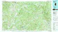
1984 Map of Kosciusko
USGS Topo · Published 1990About this map
The Big Black River and the historic Natchez Trace Parkway define the topography of central Mississippi in this mid-1980s mapping. Centered on Kosciusko, the region is a crossroads of regional transportation where the Illinois Central Gulf railroad meets a network of county seats and rural outposts. The landscape transitions from the dense timber of the Tombigbee National Forest in the east to the river lowlands near Durant and Vaiden. Local landmarks such as Arnold Mountain and Jeff Busby Park offer distinct reference points within the rolling terrain. The map captures a moment of settled stability, documenting small communities like French Camp, Ethel, and Ackerman as they appeared before modern expansion. This survey is particularly useful for identifying established property boundaries and the proximity of rural homesteads to the area's many waterways, including Big Bywy Creek and the Yockanookany River.
Find a feature on this map
42 named features on this map. Tap any name to fly to it.
Don’t see what you’re looking for? This feature index may not catch every label — zoom into the map to look around manually.
Map Details
Editions of this 1984 Kosciusko Map
3 editions found

Other maps of this area

1936 · Greenwood
USGS Topo · 1:62,500

1940 · Seven Pines
USGS Topo · 1:62,500

1940 · Lexington
USGS Topo · 1:62,500

1940 · Greenwood
USGS Topo · 1:62,500

1953 · Walthall
USGS Topo · 1:62,500

1953 · Meridian
USGS Topo · 1:250,000

1953 · Greenwood
USGS Topo · 1:250,000

1953 · West Point
USGS Topo · 1:250,000

1954 · Duck Hill
USGS Topo · 1:62,500

1954 · McCarley
USGS Topo · 1:62,500