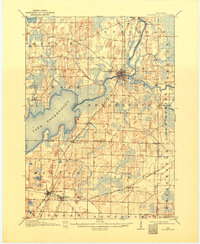
1906 Map of Koshkonong
USGS Topo · Published 1932About this map
Lake Koshkonong dominates this southern Wisconsin landscape, serving as a central hub for the surrounding glacial terrain of Jefferson and Rock counties. The Rock River winds from the northeast through Fort Atkinson, feeding the lake and defining the regional drainage pattern alongside the Bark River and Whitewater Creek. This early 20th-century survey reveals a well-established agrarian and transport network, with the Chicago and Northwestern Ry and Chicago Milwaukee and St. Paul RR intersecting at the vital rail junction of Milton Junction. Smaller settlements like Busseyville, Cold Spring, and Oakland are linked by a dense grid of rural roads, including the Prairie du Chien Div. The mapping by H. M. Wilson and Robert Muldrow captures the area before modern expansion, highlighting many family-named landmarks and small water bodies like Storrs Lake and Ripley Lake.
Find a feature on this map
37 named features on this map. Tap any name to fly to it.
Don’t see what you’re looking for? This feature index may not catch every label — zoom into the map to look around manually.
Map Details
Editions of this 1906 Koshkonong Map
3 editions found

Other maps of this area

1890 · Sun Prairie
USGS Topo · 1:62,500

1890 · Stoughton
USGS Topo · 1:62,500

1891 · Waterloo
USGS Topo · 1:62,500

1891 · Koshkonong
USGS Topo · 1:62,500

1891 · Janesville
USGS Topo · 1:62,500

1892 · Watertown
USGS Topo · 1:62,500

1892 · Whitewater
USGS Topo · 1:62,500

1893 · Delavan
USGS Topo · 1:62,500

1893 · Whitewater
USGS Topo · 1:62,500

1893 · Janesville
USGS Topo · 1:62,500